比例和投影是地图中两个基本概念,但往往没有被人关注。比例(Scale)是指地图单位与现实世界单位的关系,而投影(project)涉及将三维坐标转换为二维坐标的方法。
接下来将介绍到:
- 比例尺、以及告诉地图用户测量的方法
- 投影原理、投影分类以及它们的特点
最后,你应该能够看懂地图比例尺、分辨常用的地图投影,理解基本特征和用途。
Scale
地球很大,表面积超过5亿平方公里,你能轻易携带的地球图片只能展示各大洲和国家的大体轮廓。所以当我们想在地图上直观地观察某一区域时,我们务必会收缩它的尺寸。比例尺衡量了真实尺寸特征被缩小了多少。或者更准确地说,地图比例尺显示了地图上给定距离与现实世界中地面上相应距离的比例。
地图比例有 分数、图形、文字描述 三种表现形式。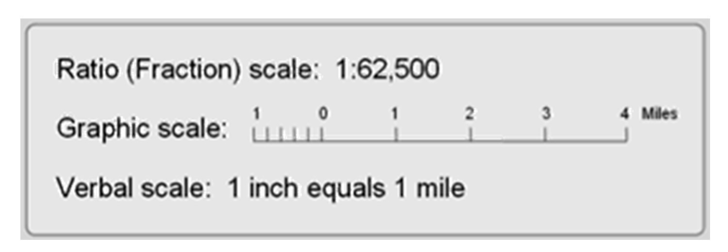
Representative fraction 是最常用的比例表示法(RF)。其由一个比率表示,分子始终为1,分母表示真实世界距离有多大。
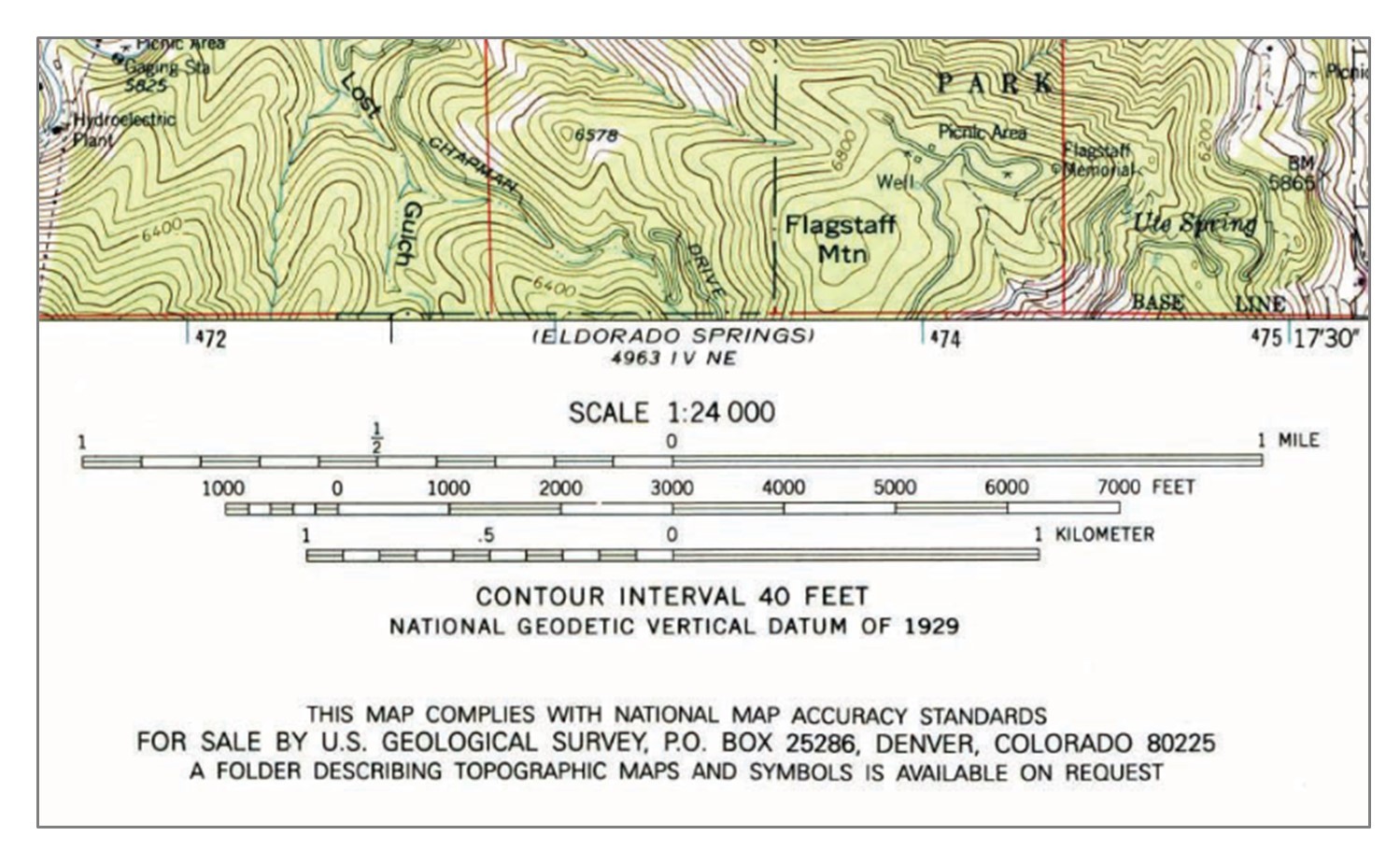 Representative fraction.Representative fraction and scale bars from a United States Geological Survey (USGS) topographic map. This topographic map has an RF of 1:24,000, which means that one unit on the map represents 24,000 units on the ground.
图像比例尺用图像表示地图上的距离。一个显著的优点是地图图像的比例更改也不会影响它。而一些文本描述的比例通常在老地图上出现,例如你能看见诸如“一英寸表示一千米”的字样。
当我们谈到比例尺的大小时,我们往往谈的是地图表示特征的详细程度,一般来说,地图比例尺越大,显示的细节越多。
Extent 与 Resolution
地图的范围(Extent)描述的是地图上可见的区域,而分辨率(Resolution)描述的是地图上显示的最小单元。下图的Extent是美国全国,而Resolution 是州。
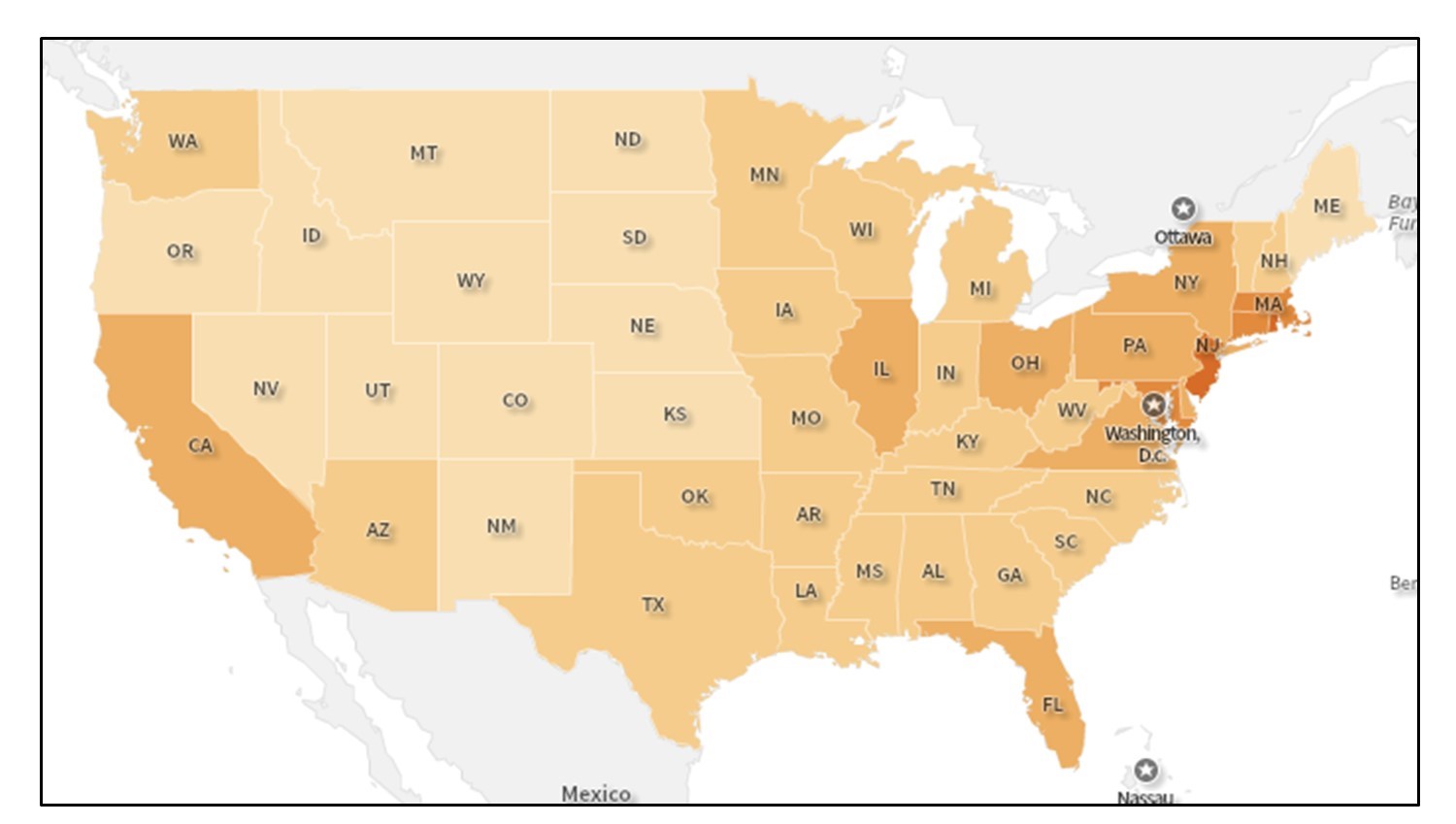
Map resolution and extent. This map shows a national extent and a state resolution. The extent of the map is national while the resolution is at the state level because they are the finest level of spatial detail that we can see.
我们会有意地选择地图的分辨率以更好的展示各种数据,如果我们尝试以人口普查区块的分辨率显示全国范围的地图,则会使地图非常精细,以至于很难理解地图的任何内容。平衡范围和分辨率通常是制图师必须做出的最重要和最困难的决定之一。下图提供了两个关于范围和分辨率之间差异的示例
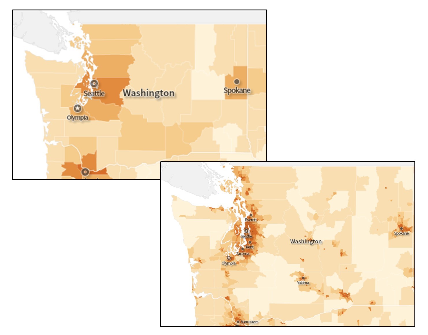 More map extent and resolution. Maps showing an extent of the Pacific Northwest. The top image has a spatial resolution of the county and the bottom has a spatial resolution of census tracts.
Coordinates 与 Projections
地球表面的位置是用一组两个或多个数字的坐标来表示的。最简单的是笛卡尔坐标系,以 17 世纪数学家和哲学家勒内·笛卡尔 (René Descartes) 的名字命名。笛卡尔坐标系只是将两个测量刻度放在一起形成的网格。
 Coordinate system. Locations on the Earth’s surface are measured in terms of coordinates, a set of two or more numbers that specifies a location in relation to some reference system.
地理坐标系统是专门设计来定义地球大致球面上的位置的。地理坐标系统不像笛卡尔坐标系那样使用
- 东西刻度,称为经度,范围从
到 。因为地球是圆的,所以 (或 )和 (或 )是同一条网格线,称为国际日期变更线。与国际日期变更线相对的是本初子午线,即定义为 的经线。 - 南北刻度,称为纬度,范围从北极的
(或 )到南极的 (或 )。
简单来说,经度指定东西位置,纬度指定南北位置。在高纬度地区,平行线的长度在南北纬90度处减小为零。经线不是平行的,而是向两极汇聚。
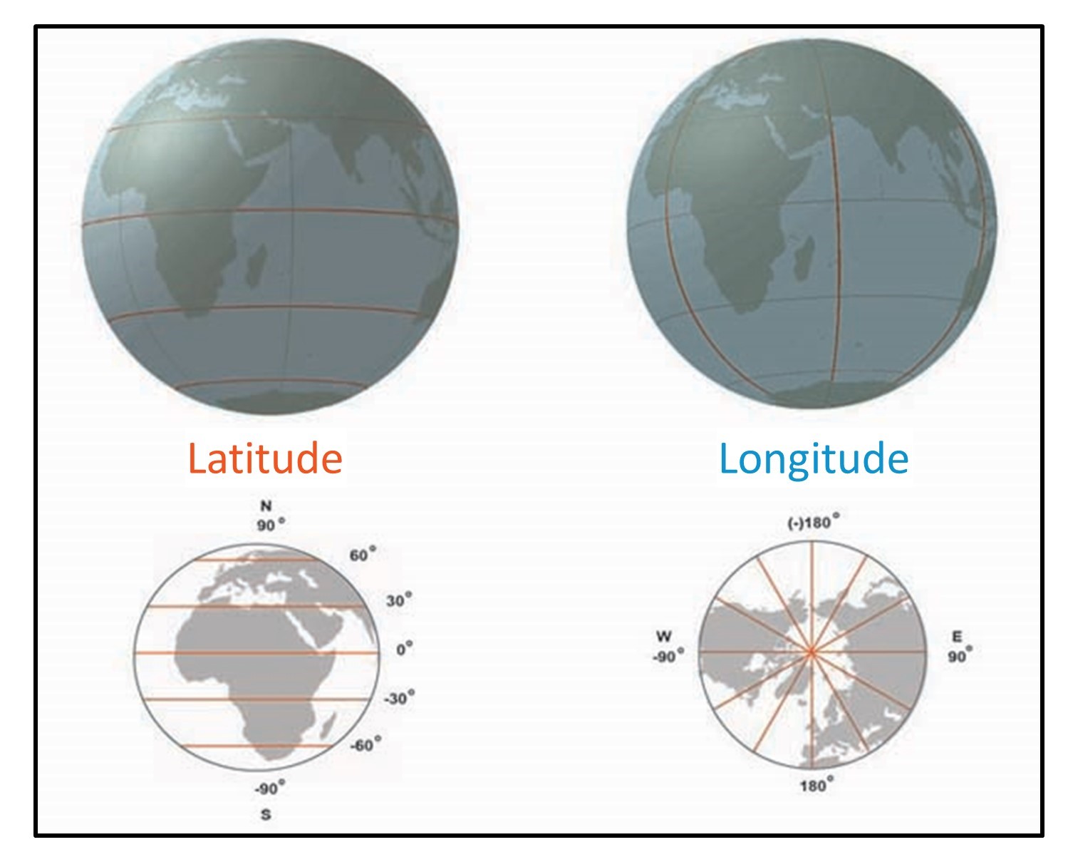 Longitude and latitude. The graticule is based on an east-west scale called longitude and a north-south scale called latitude.
光栅用(graticule)纬度和经度坐标指定地球上的位置。光栅(graticule)指的是三维地球仪上的经纬度。当我们在二维地图上使用经度和纬度时,我们将它们称为地理坐标(geographic coordinates)。地图可以有大量不同的坐标系统,这取决于谁开发和使用它们。
投影(project)是把一个三维球体变成一个二维地图的术语。如上所述,地球仪上的光栅(geographic coordinates)是有用的,但我们如何从三维光栅转换到二维地理坐标?如下图所示
我们将讨论三维表面(地球)上的物体如何在纸张或电脑屏幕上表现出来的过程。我们的重点将放在不同投影所扭曲或保持的属性上。
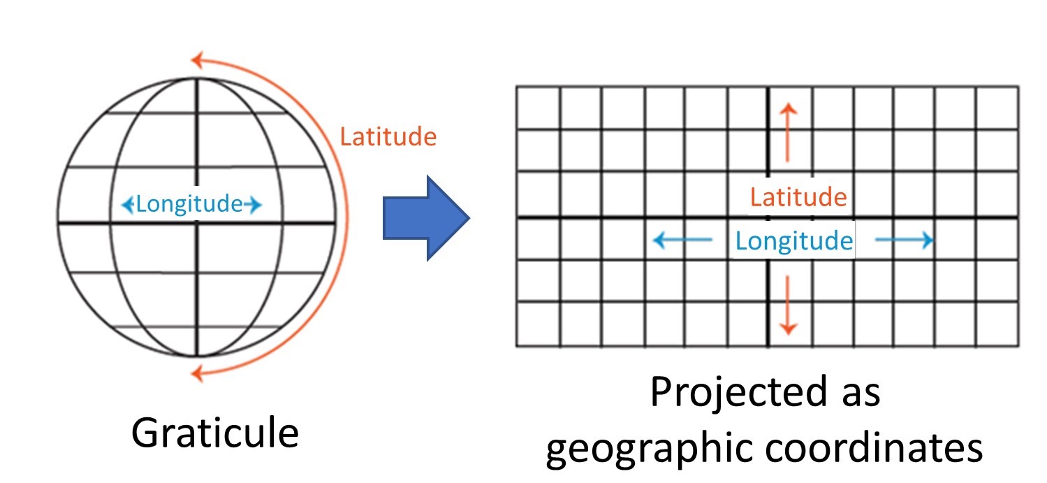 Graticule projected. The longitude and latitude of the graticule become two-dimensional geographic coordinates through projection.
投影是将三维地球仪绘制成二维地图的过程。我们可以把地球想象成一个球体(实际上,它更像是一个带有一些凸起的椭球体)。为了了解这个过程有多困难,想象一下剥掉橙子的皮,并试着把它放平。

在你尝试的过程中,你可能会遇到以下问题:
- 剪切,在一或多个方向拉伸
- 撕裂
- 压缩,产生了很多的褶皱
当制图师试图将三维地球转换成二维地图时,他们也面临着同样的三个问题。如果你有一个纸做的地球仪,你可以小心地试着把它“剥”成一张平的纸。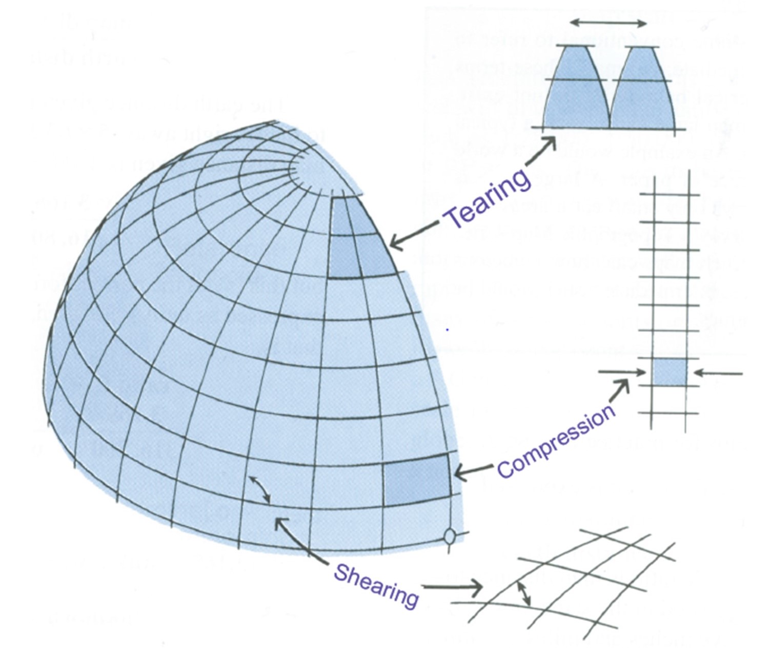 Shearing, tearing, compression. Cartographers face these three issues of shearing, tearing, and compression on a globe when they try to transform the three-dimensional globe into a two-dimensional map.
投影的原理
“地图投影”一词是指将三维球面上的空间坐标转换为二维平面的过程和结果。就实际而言,大多数投影使用数学函数,将球体上的位置作为输入,并将其转换为二维表面上的位置。
如果你有一个沙滩球大小的透明球,在球里放一盏灯,它就会在周围的表面上投下阴影。你把一张纸包裹在地球上,仔细地把这些阴影画在纸上,然后把这张纸摊平,就得到了你的一个投影。
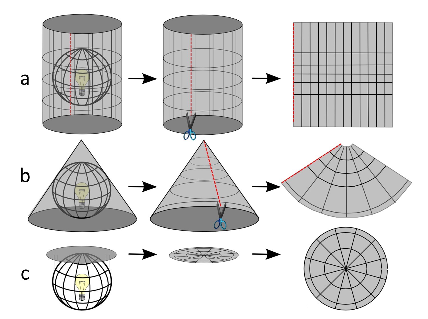 Thinking of projections in physical terms. You can conceptualize projection as working with a clear globe, a light bulb, and tracing paper. If you had a clear globe the size of a beach ball and placed a light inside this globe, it would cast shadows onto a surrounding surface. This surface can be a (a) cylinder, (b) cone, or (c) plane.
大多数投影将地球的一部分转换为三种可以展开的表面之一——平面、圆锥和圆柱体。由此产生的投影被称为平面、锥形和圆柱形投影。我们使用可展曲面是因为它们可以消除撕裂,尽管它们会产生剪切和压缩。在这三个问题中,撕裂是最严重的问题,因为这会使你制作的地图产生空洞。
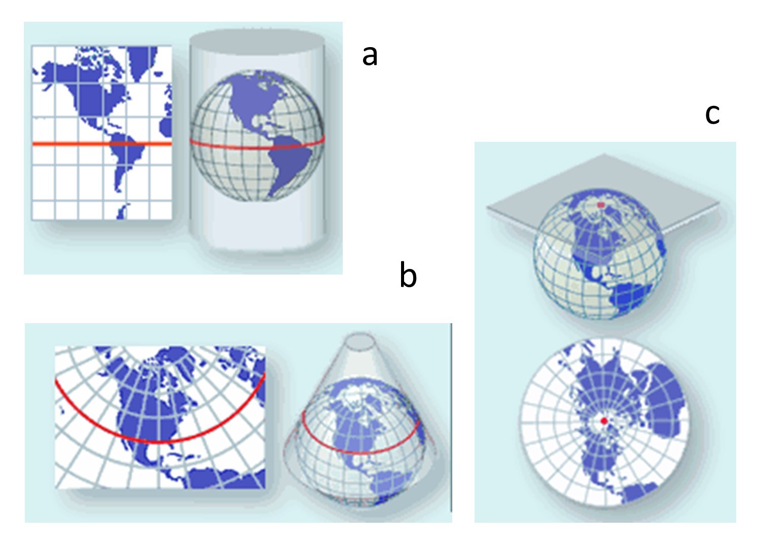 Tangency. Red lines or dots mark the tangent line or point respectively. The flat surface touches the globe and it is the point on the projected map which has the least distortion. the place where the developable surface touches the globe is known as the tangent point or tangent line. These surfaces can be a (a) cylinder, (b) cone, or (c) plane.
可展曲面与球体接触的地方称为切点或切线。地图在这些切点或切线上不会失真,但距离这些切点或切线越远时,失真会越严重。正因如此,圆柱体投影通常用于赤道附近地区,圆锥用于绘制中纬度地区,平面用于极地地区。
投影在展平地球表面的过程中必定会扭曲其表面特征,因为投影涉及剪切、撕裂和压缩。由于没有投影可以保留所有属性,因此地图制作者需要知道哪些属性对其目的来说是最重要的,并选择合适的投影。我们将关注的属性是形状、面积和距离。
mention :
请注意,变形不一定与可展曲面的类型有关,而是与用该曲面进行变换的方式有关。使用任何可展曲面都可以保留这三种性质中的一种。
Conformal
保形投影(Confomal Projection)保留了形状和角度,但在此过程中会严重扭曲面积。例如,使用墨卡托投影,海岸线的形状在地图的所有部分都是准确的,但相对于赤道附近的国家,靠近两极的国家看起来要比实际大得多。例如,格陵兰岛的面积只有非洲的7%,但它看起来和非洲一样大!
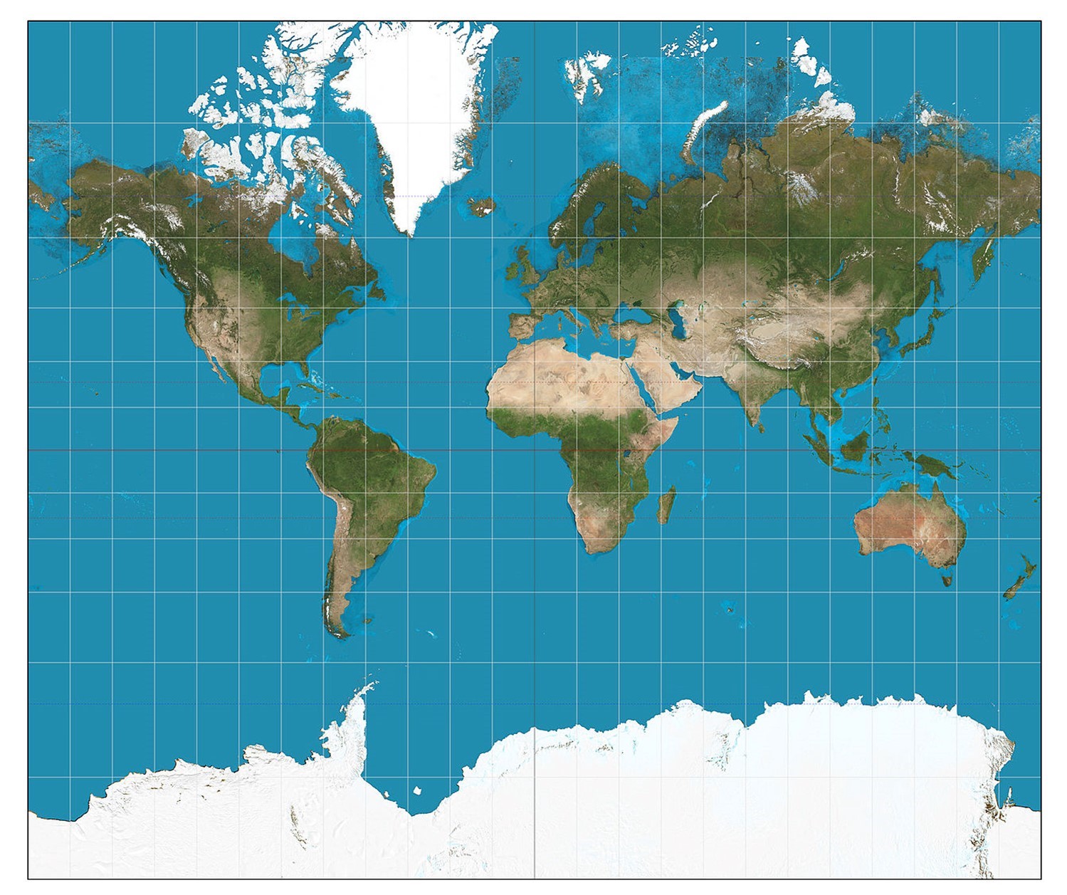 Mercator projection. The Mercator projection is conformal because it preserves shape and angle but strongly distorts area.
如果地图的主要目的是测量角度或表示地物的形状,则应使用保形投影。它们对导航、地形图(高程图)和天气图非常有用。
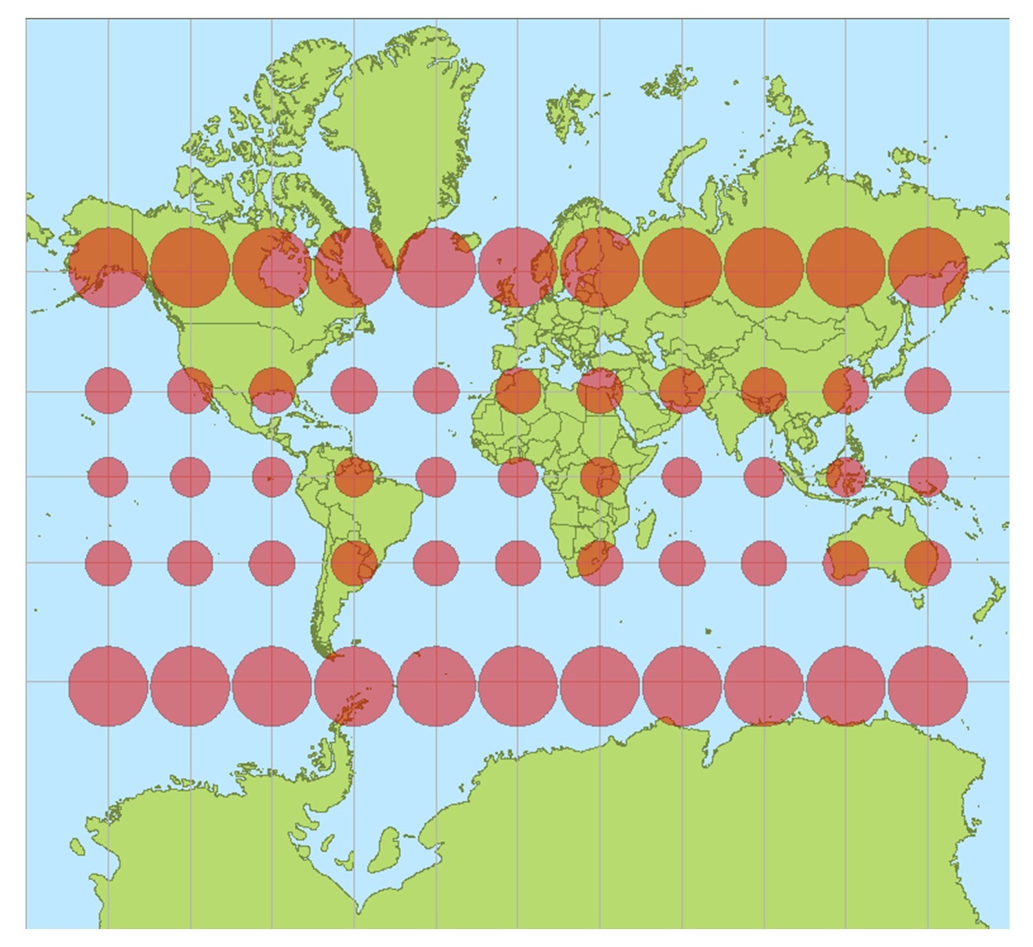 Mercator distortion. The Mercator projection is conformal because it preserves shape and angle but strongly distorts area.
Equal Area
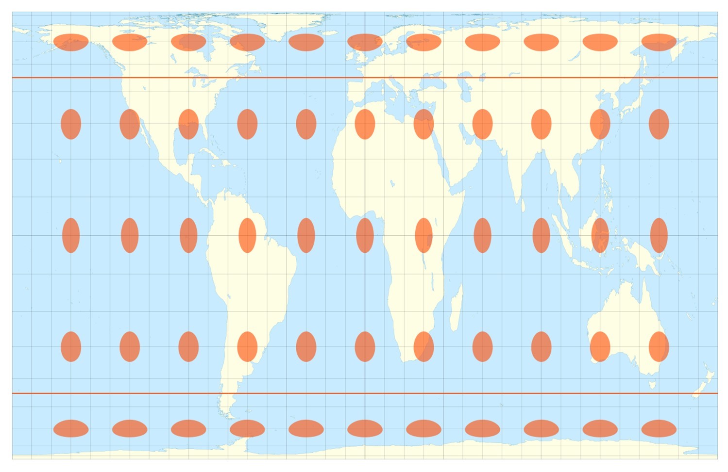
在等面积投影(Equal Area Projection)中,地图上任何区域的大小都与地球上的真实大小成正比。换句话说,与地球上的国家相比,国家的形状可能会被压扁或拉伸,但它们的陆地面积相对于其他陆地是准确的。例如,在盖尔-彼得斯投影中,格陵兰岛的形状发生了明显的变化,但与非洲相比,其面积的大小是正确的。
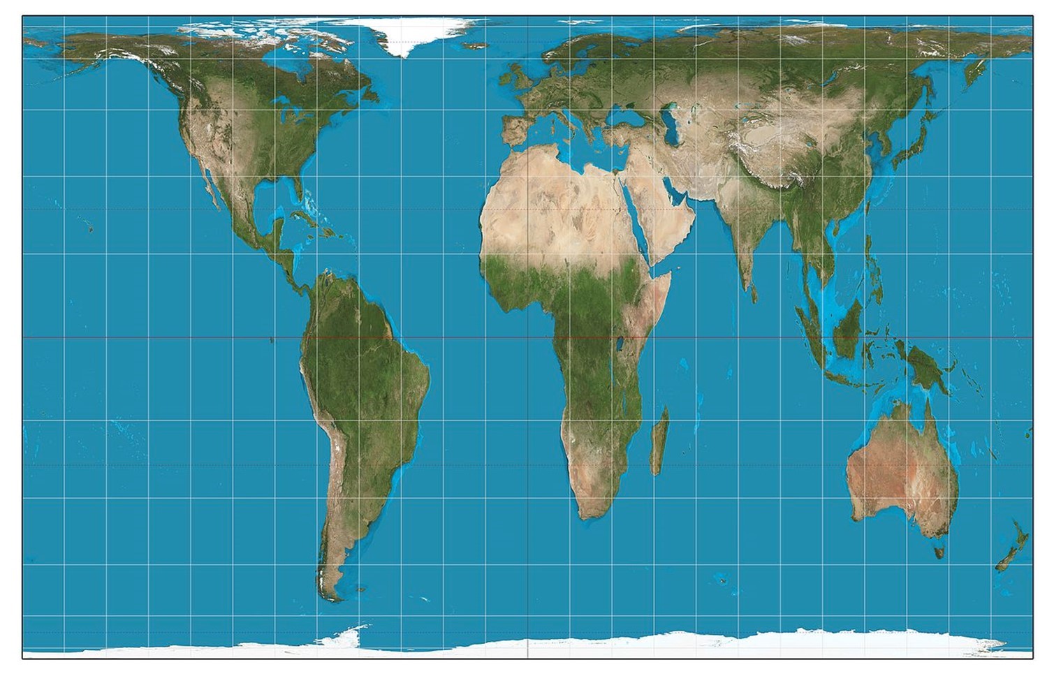 Gall-Peters projection. The Gall Peters projection is equal area. Note how the shape of Greenland is significantly altered, but the size of its area is correct in comparison to other regions such as Africa.
然而,正如我们在等面积投影中看到的那样,椭圆在地球上的区域大小中保持正确的比例,但它们的形状是变形的。等面积投影是小比例尺制图的首选方法。
Equidistant
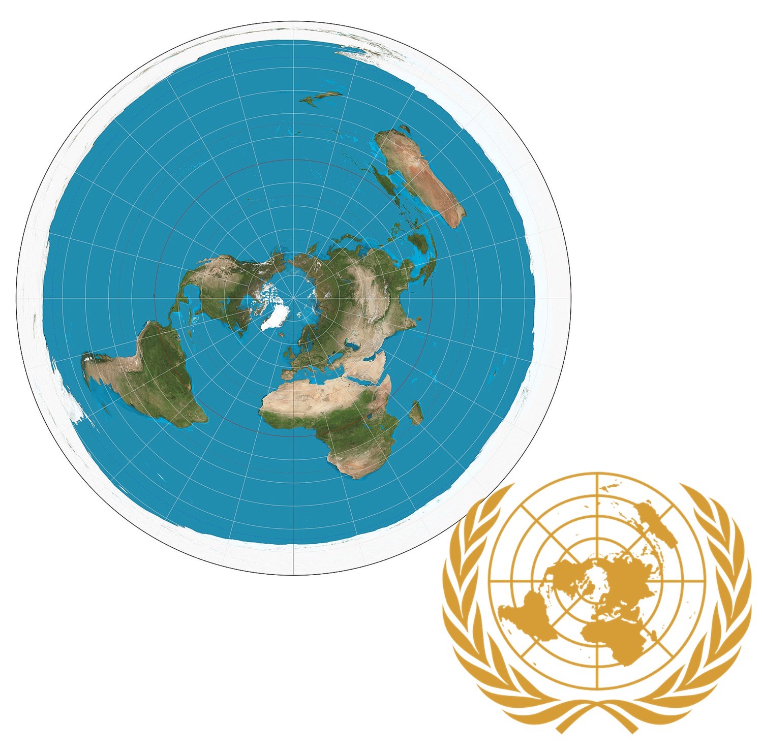
等距投影(Equidistant Projection),这个名字有些误导性,因为没有投影可以保持地图上所有地方之间的相对距离。然而,等距地图能够沿着一些明确指定的线保持距离。例如,在方位角等距投影(Azimuthal Equidistant projection)上,所有点与中心点的距离和方向都成比例。这种类型的投影在可视化从一个城市到其他几个城市的飞机飞行路径或绘制地震震中时非常有用。方位角投影在一定程度上以形状和面积扭曲为代价来保证距离的比例准确。联合国的旗帜上有一个极方位角等距投影的例子。
妥协
包括罗宾逊投影(Robinson projection)在内的一些投影方法在不同的属性之间取得了平衡。换句话说,它们不是只保留形状、面积或距离,而是尽量避免任何这些属性的极端失真。这种类型的投影对于通用世界地图非常有用。
 Robinson Projection. Some projections, including the Robinson projection, strike a balance between the different map properties. In other words, they do not preserve shape, area, or distance, but instead try to avoid extreme distortion.
其他投影则通过在一些重要位置撕开平面来将三维地球变平。
间断投影(如间断的Goode Homolosine projection)以分裂的几片来表示地球,减少了两极附近的形状和面积变形。该投影由约翰-保罗-古德(John Paul Goode)于 1923 年开发,为墨卡托投影提供了一种替代方案,用于描绘全球区域关系。
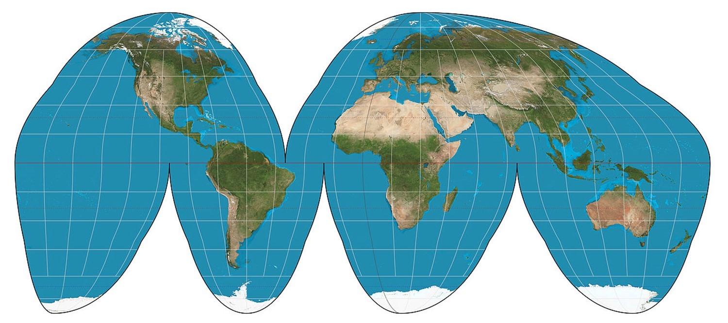 Goode homolosine projection of the world. This equal-area projection is interrupted in the sense that it uses lobes or sections.
它是等面积的,但不是保形的。
References
- Laura Matson and Melinda Kernik. Scale and Projections https://open.lib.umn.edu/mapping/chapter/3-scale-and-projections/